Discover how Draw Your Own Area property search lets buyers draw a custom area on a map and find homes within it. A smarter way to search real estate internationally.
Buying a property does not always start with the name of a city, municipality or neighbourhood. In many cases, buyers know exactly where they want to live, even if that area does not match a predefined administrative boundary.
They may want a home along a particular stretch of coastline, between two towns, near an international school, within easy reach of an airport, or simply inside a specific area they already know.
That is exactly what MiMove’s Draw Your Own Area property search is designed to solve.
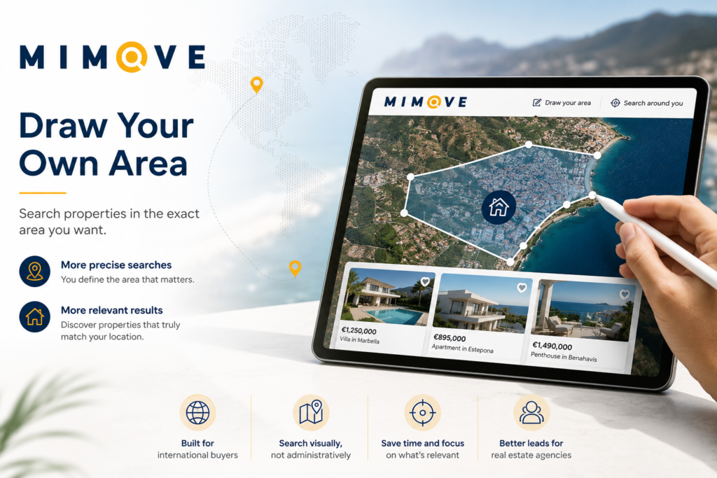
Instead of forcing buyers to adapt their search to predefined geographical categories, the platform allows them to draw a custom area directly on a map and search only within that location.
Why Draw Your Own Area Property Search Matters
Traditional property portals usually require buyers to select a location such as a country, region, municipality, city or neighbourhood.
This works well when buyers already understand the local geography.
For international property buyers, however, this is often not the case.
Someone searching for property in Spain, Portugal or France may know the coastline, major roads, beaches or towns they prefer without knowing exactly where one municipality ends and another begins.
A map-based property search is therefore far more intuitive.
Instead of asking:
“Which administrative area would you like to search?”
the experience becomes:
This small change in user experience represents a significant shift in how search intent is captured and translated into property results.

From Predefined Locations to Buyer-Defined Geography
When buyers draw their preferred search area directly on a map, they communicate their geographical intent much more accurately.
With a traditional location filter, the platform defines the geographical categories.
With a draw-on-map property search, the buyer defines the geography.
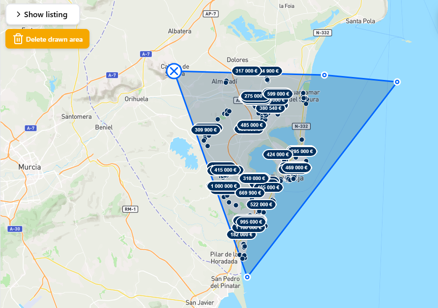
From a technical perspective, the area drawn by the user becomes a polygon made of geographical coordinates. Every property is stored as a geographical point using latitude and longitude.
The search engine then performs a point-in-polygon operation to determine which properties fall inside the selected area.
This introduces powerful geospatial search technology into the property-buying experience.
Reducing the Gap Between Search Intent and Property Results
A conventional property search usually follows this path:
Buyer intent → interpretation of the area → location name → predefined filter → property results
With Draw Your Own Area property search, the process becomes:
Buyer intent → map selection → property results
One layer of interpretation disappears completely.
Buyers no longer need to translate the area they have in mind into the administrative geography used by the property portal.
The map itself becomes the search parameter.
Why International Property Buyers Benefit the Most
This functionality becomes particularly valuable when searching for property abroad.
Imagine a buyer living in Stockholm who wants to purchase a home on the Costa del Sol.
They may know:
- Which beaches they prefer
- Which roads they use most often
- How far they are willing to travel from Málaga Airport
- Which coastal areas feel right to them
However, they may not understand the municipal boundaries between Marbella, Estepona, Benahavís and Mijas.
And they should not need to.
A map-based property search interface becomes a universal geographical language that works regardless of nationality or local administrative knowledge.
More Relevant Property Searches Lead to Better Buying Decisions
The goal is not simply to return fewer properties.
The goal is to return more geographically relevant properties.
A municipality-level search may include many listings that technically match the selected location while still falling outside the area the buyer genuinely wants.
Drawing a precise area creates an additional filtering layer before the buyer even starts comparing individual homes.
The process becomes much more efficient:
- – Define the actual area
- – Eliminate irrelevant listings
- – Explore only relevant properties
- – Identify stronger purchase candidates
For international buyers who may be hundreds or thousands of kilometres away from the properties they are considering, this additional precision is extremely valuable.
What This Means for Real Estate Agencies
Geospatial search is not only a user-experience improvement.
It also provides better information about real buyer intent.
A buyer who simply selects “Málaga” gives relatively broad geographical information.
A buyer who draws a specific section of the Costa del Sol communicates something much more precise:
“This is the area where I want to buy.”
That distinction matters.
For a real estate agency, buyer qualification depends on understanding several variables:
- – Budget
- – Property type
- – Number of bedrooms
- – Purchase timeframe
- – Geographical intent
The more accurately buyers can express where they want to buy, the more effectively properties can be matched to their requirements.
Better Geographical Intent Creates Better Property Matching
A valuable relationship begins to emerge:
Better geographical input → More relevant property discovery → Stronger buyer–property alignment
For agencies listing properties on an international property portal, the value goes beyond visibility.
The objective is not simply to generate more enquiries.
The objective is to generate enquiries from buyers whose geographical preferences genuinely align with the property being marketed.
A buyer who discovers a listing because it falls inside an area they deliberately drew has already revealed an additional layer of purchasing intent.
This does not automatically create a qualified lead.
However, it provides significantly more context than a broad location search alone.
In international real estate, that context can be extremely valuable.
When Technology Becomes Invisible
One of the most powerful aspects of geospatial property search is that buyers never need to understand the technology behind it.
They do not need to know what polygon geometry is.
They do not need to understand spatial databases.
They do not need to know what a point-in-polygon operation does.
They simply draw.
The complexity belongs to the technology. The simplicity belongs to the user.
That is exactly what modern property-search technology should achieve.
Property search is becoming less about asking buyers to understand geography the way a database stores it — and more about allowing technology to understand geography the way buyers naturally perceive it.
Frequently Asked Questions
What is Draw Your Own Area property search?
It is a map-based property search feature that allows buyers to draw a custom area directly on a map and view only the properties located within that area.
Why is searching property by map useful?
It helps buyers find homes based on where they actually want to live, rather than forcing them to choose predefined cities, municipalities or neighbourhoods.
Is map-based property search better for international buyers?
Yes. International buyers often know coastlines, roads, beaches or landmarks better than local administrative boundaries, making a draw-on-map search far more intuitive and accurate.
How does Draw Your Own Area search work?
The selected area is converted into a geographical polygon, and the property database performs geospatial queries to display only the listings located inside that custom search area.